
Trace a Tulare Street Address
A useful street directory walk keeps the address fixed while changing the record source. Start with the physical location, not a guessed occupant. The assessor's public search accepts an address, landmark, or APN. Save the APN and map context, then use the Recorder to identify a current deed. From there, names and legal descriptions carry the trail. The County CSS permit system applies to unincorporated locations, while City permit history belongs at the City counter or through a City Clerk request.
Each stage answers a different question. An assessor page describes land and assessed data. A deed identifies parties to an instrument. A permit can name an applicant, owner, or contractor. A historical directory can place a printed name at an address in a specific year. None alone is a full list of people along a Tulare street.
- Enter the street address in the Tulare County Assessor property search, or use the APN if it is already known.
- Open the county GIS or map link and record the parcel shape, situs, APN, and legal description when shown.
- Search the Recorder by the current party name, document number, or document type, testing spelling variants.
- Check the City Clerk or County CSS route for address-keyed permits after determining whether the parcel is incorporated.
- For an older resident trail, ask the Hillman room for a directory year and reverse section before drawing a conclusion.
That sequence is the core of a Tulare street directory: address to parcel, parcel to party, party to instrument, then a separate source for occupancy or history.
Tulare Records Along a Street
Address-keyed records vary in both coverage and meaning. A street directory table should make those differences visible instead of presenting every result as a resident. The Recorder's address role is indirect: use the address to reach a parcel, then search parties and legal descriptions. The state voter form is not a street search at all.
| Record set | Address key | What it can show | Access |
|---|---|---|---|
| Assessment information | Address, APN, landmark | Parcel identity and current assessed data | County linked viewer |
| Assessor GIS | Map, address, APN | Parcel geometry and nearby parcels | Free map and open-data channels |
| Recorded documents | Party, document number, type | Ownership history, liens, maps, notices | Index, paid image, counter or mail |
| City permit or plan file | Address or legal description | Work history and named application parties | City counter or CPRA request |
| County CSS permit | Address or APN | Unincorporated permit detail and status | Public lookup |
| Printed directories | Name and sometimes reverse street section | Historical occupant or business when printed | Hillman room, onsite |
The full historical shelf belongs in the Tulare city directory section of this guide. This street directory keeps the focus on the present address pivot and on what each address record can actually establish.
Tulare Street Directory Search Fields
The County Assessor's public description identifies three search modes. The page advertises assessment or APN, street address, and landmark. It does not verify a public owner-name search, so a street directory should not promise one. A parcel search is free to inspect, but a free map is not a deed image or a residence roll.
| Field or mode | Type | Required | Format and role |
|---|---|---|---|
| Street Address | Text | One search key | Use the physical situs address |
| Assessor's Parcel Number / Assessment | Text | One search key | Use the parcel identifier as the stable pivot |
| Landmark | Text or map search | One search key | Useful when a full address is missing |
The Tulare County Assessor landing page is the source for the search modes shown here.
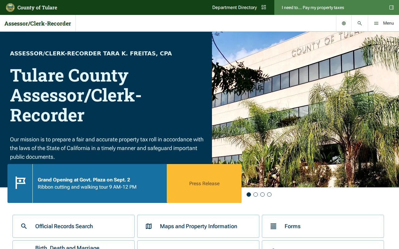
The assessor screen is most useful as a parcel starting point. Preserve the APN before moving to the Recorder or permit custodian.
Browse Tulare Street Parcels in GIS
The county GIS link and Assessor GIS Maps provide a map view of parcel geometry and context. The City of Tulare also publishes ArcGIS services at maps.tulare.ca.gov, including address and planning layers. A map can help identify which parcels touch a target address, but the research did not verify every dynamic popup field, measuring tool, or layer-control label.
For a careful street directory pass, zoom until parcel lines are distinct, record the target APN, then browse adjacent polygons one at a time. Open each selected parcel in the relevant assessment route instead of treating the map label as an owner or household. If the postal city says Tulare but the parcel is outside the incorporated line, route permits to County RMA rather than City Building.
County Address Points and standardized street-name fields can help resolve a hard-to-read location, but the public metadata does not identify the assignment office or a numbering baseline. Use those fields to find the parcel, then rely on the named custodian for ownership, permit, or deed facts.
GIS is a geographic aid. It does not expose utility customers, delivery accounts, casual voter lists, or every person at a parcel.
Tulare Street Address Terms
Address records use terms that look alike but do different work. Keep them separate when comparing a property result with a deed, map, or permit. A mismatch is a reason to check the parcel, not a reason to force two records together.
- Parcel
- A mapped piece of land identified by an APN and related assessment data.
- Situs address
- The physical location of the property. It tells a map where the land sits.
- Mailing address
- The route for notices or tax statements. It may belong to an off-site owner, trust, manager, or mailing service.
- Legal description
- The deed's formal description of the land. It can preserve identity when a street number or APN changes.
- Criss-cross directory
- A reverse directory organized by address or street when a particular volume includes that section.
County pages did not confirm public display of a mailing address, and the public property landing page did not confirm owner-name search. A matching situs and mailing address can support a clue, but it does not prove owner occupancy.
Tulare Street Permit Custody
Tulare's city-county boundary changes the custodian. City permits and plan files can cover construction, alteration, repair, moving, demolition, occupancy changes, and regulated building systems. Unincorporated permit details are routed through County RMA's CSS location workflow. Postal city is not enough to choose the office.
| Location or record | Custodian | Search path | What it adds |
|---|---|---|---|
| Incorporated City of Tulare | City Building / City Clerk | Counter or public-record request | Named applicant, owner, contractor, or work chronology when public |
| Unincorporated Tulare County | County RMA | CSS Address or Parcel search | Permit detail, status, inspections, and associated address |
County CSS uses Add Location, Address or Parcel, APN entry, Search, an action checkbox, Search Associated Address, and Add Selected. That route serves unincorporated parcels and should not be presented as the City of Tulare's historic permit portal.
Walk the Tulare Deed Chain
The Recorder is where an address search becomes a name chain. First use the assessor to identify the parcel. Then search the current owner or known party in the Recorded Documents index. The recorder confirms name, document number, and document type modes, and advises spelling variants. The index locates the instrument; the copy or image supplies the operative terms.
- Save the parcel's situs, APN, map, and legal description.
- Find the acquisition deed and note grantor, grantee, recording date, document number, and legal description.
- Search the seller as an earlier grantee and test name variants.
- Use the legal description to survive an APN or street-number change.
- If the online cutoff is unclear, use Room 103 public computers, microfiche, mail, or a paid copy request.
Recorder copies can be requested online, at the counter, or by mail. Mail payment is payable to Tulare County Assessor/Clerk-Recorder and cash should not be sent. A deed party is not automatically the person who lived at the address.
Historical Tulare Street Clues
Printed directories and Sanborn maps can keep a street's past in view when modern address records stop. Hillman holdings include Tulare directories beginning in 1888, county and telephone titles, and a gapped Polk's run through 1993. Library of Congress Sanborn sheets cover Tulare in 1885, 1887, 1892, 1906, and 1913. A Sanborn sheet shows building footprint, use, and structure context, not occupants.
The research did not locate an official street-renumbering year for Tulare. If a number seems to vanish, compare the legal description, subdivision map, lot and block reference, Sanborn sheet, and cross-year directory address. Do not invent a renumbering date or treat a changed number as proof of a move.
The reverse-directory collection itself is treated in the Tulare city directory archive; the street directory uses it only as a historical address tool.
Request Tulare Permit Files
For a City record that is not online, use the City public-record request form. Describe the street number, street name, parcel or legal description, permit or case type, and date range. The form offers electronic delivery, physical copies after payment, and inspection by appointment. Electronic records and inspection are free. Ordinary copies are listed at $0.10 black-and-white, $0.25 color, and $6 for a CD.
Permit plans may require extra authorization before duplication. Police records use separate contacts and exemptions. The City says the CPRA determination period is ten days, not an absolute production deadline. For county-created files, use the County Clerk of the Board CPRA route and name the existing record you want.
A narrow request is faster and safer than asking for everything associated with a person. Address-keyed work history can add dates and named parties, but it does not enumerate a household.
Tulare Voter Data, Not a Street List
My Voter Status verifies an individual through identity inputs. It does not let an ordinary reader search every registered voter on a Tulare street. Elections Code section 2194 restricts voter-file access to approved purposes, and Government Code section 7924.000 protects home street address, phone, email, precinct and registration identifiers, prior registration data, credential numbers, and signatures outside the statutory file regime.
An approved file request identifies the requester, organization, statutory purpose, requested geography or data, and agreement against unauthorized use. The researched county file price and delivery method were not verified. A lawful voter record may show status or electoral geography where released, but participation means whether someone took part, never how they voted.
Limits of a Tulare Street Directory
Parcel ownership is not a complete resident list. A street directory built from public address records may miss non-owner occupants, children, roommates, protected voters, utility customers, delivery accounts, and people whose information is withheld by law. A tax mailing address can be offsite. A business or license address can be a work or filing location. A court hit can involve a plaintiff, defendant, attorney, witness, or other role.
Lawful use. Use Tulare street records for personal history, family research, reconnecting, property curiosity, or civic work. Do not republish a block list or use an address trail to stalk, harass, intimidate, or harm anyone.
When the question shifts from a whole street to one person, use the Tulare resident lookup. When it shifts backward through one address, use the prior-resident trail. The street directory remains strongest when its parcel and jurisdiction limits stay visible.