
Tulare Neighbors Around One Address
For a Tulare neighbors search, begin with the source that matches the claim. GIS shows geometry. The assessment record adds parcel and assessed data. A deed shows parties to an instrument. A permit names public application parties where the file allows it. Historical directories may show a printed household or business in an earlier year. The voter file remains restricted.
| Source | What it shows about a block | Access |
|---|---|---|
| GIS polygons | Neighboring land parcels and boundaries | Free map browse |
| Assessment record | Ownership or assessed data for a selected APN | County viewer; not occupancy |
| Recorder | Earlier owners and recorded instruments | Index, copy, counter, microfiche, or mail |
| City or County permits | Named public application parties and work history | City request or County CSS |
| Historical directories | Printed occupants or businesses when a reverse section exists | Hillman room |
| Voter file | Approved-purpose registration data only | Not a public neighbor directory |
The purpose is to create a careful block map, not to fill every address with a person's name. A property owner, an occupant, a business, and a historic directory entry are separate records.
Map a Tulare Neighbor Block
For a Tulare neighbors lookup, the adjacent-parcel method starts with a known address and works outward. Use the county Assessor GIS or the City of Tulare ArcGIS services to identify the target parcel. Zoom until polygons are distinct, then browse the parcels that touch it. Record each APN and open the assessment record separately. Do not infer a person from a map label alone.
- Enter the target address or APN in the county property or GIS route.
- Save the target parcel shape, APN, situs, and jurisdiction.
- Click surrounding polygons and make a list of adjacent APNs.
- Review each selected parcel through the assessment record, then use the Recorder for a deed question.
- For a whole named street, switch to the Tulare street directory walkthrough.
The research did not verify exact dynamic popup fields, measuring controls, or buffer labels. A precise map method should stay within the controls that the live viewer actually exposes.
Tulare Neighbor GIS Shows Parcels
The County GIS and City ArcGIS services are geographic tools. They can show parcel polygons, address points, planning layers, and nearby land. They do not expose a public utility-customer list, animal-license directory, delivery account, or full household roster. A selected APN is a parcel clue, not a list of everyone who may be present.
Keep the physical location, mailing address, legal description, and APN distinct. A mailing address may be offsite. A legal description can remain steady when a street number changes. A postal city may cross the incorporated line. These distinctions matter when a Tulare neighbors search moves from map to custodian.
The City of Tulare ArcGIS service directory and the County Assessor page provide the researched map routes.
Tulare Neighbor Jurisdiction Lines
Determine jurisdiction before requesting block records. An address that uses Tulare as its postal city may be incorporated or may sit in an unincorporated area handled by County RMA. City Planning handles city subdivisions, annexations, the General Plan, zoning, and specific plans. County policy addresses urban growth and agricultural land beyond the city line.
| Block question | Incorporated City of Tulare | Unincorporated area |
|---|---|---|
| Permit history | City Building or City Clerk request | County RMA CSS lookup |
| Planning layer | City ArcGIS and planning materials | County planning and GIS route |
| Public-record request | City Clerk CPRA channel | County CPRA channel or creator office |
Jurisdiction is a geography question, not a ZIP-code question. Confirm the parcel before asking either government for a neighbor-related record.
Tulare Neighbor Permit Context
City permit and plan files can cover construction, alteration, repair, demolition, moving, occupancy changes, and regulated electrical, gas, mechanical, or plumbing work. The City Permit Center is at 411 E. Kern Avenue and lists 559-684-4218, with weekday counter hours of 8 to 5 and published submission hours of 9 to 4. The City public-record form accepts a record description and date range, delivery choice, contact information, and an optional file.
County CSS uses an address or parcel workflow for unincorporated permit details and inspections. The named applicant, owner, contractor, or agent can explain a public project, but a permit does not tell the block who currently occupies a property. Request only the existing address-keyed file needed for the question.
Compare a Tulare Block in Old Directories
Historical directories can add a human layer to a block map when an edition has a street or reverse section. Hillman holds Tulare titles from 1888, 1904-05, 1908-09, 1921, 1925, 1932-33, and a gapped Polk's run from 1934 through 1993. The geographic scope changes, and later city titles include Pixley, Tipton, and Woodville.
Read the exact address, title, year, and abbreviation key. Pair the line with a Sanborn sheet or census record when the goal is family history. A city directory can show a printed name at a past date, but it cannot update a current block map. The collection and reading method belong on the Tulare city directory page.
Tulare Neighbor Voter Status Limits
California My Voter Status is an individualized form. It asks for first name, last name, date of birth, and conditional credential fields. A successful check can return registration status, party preference, county, precinct or election information, polling place or vote-center details, and ballot status as applicable. It cannot be used to list registered neighbors by address.
The California My Voter Status form demonstrates the identity gate used for an individual check.
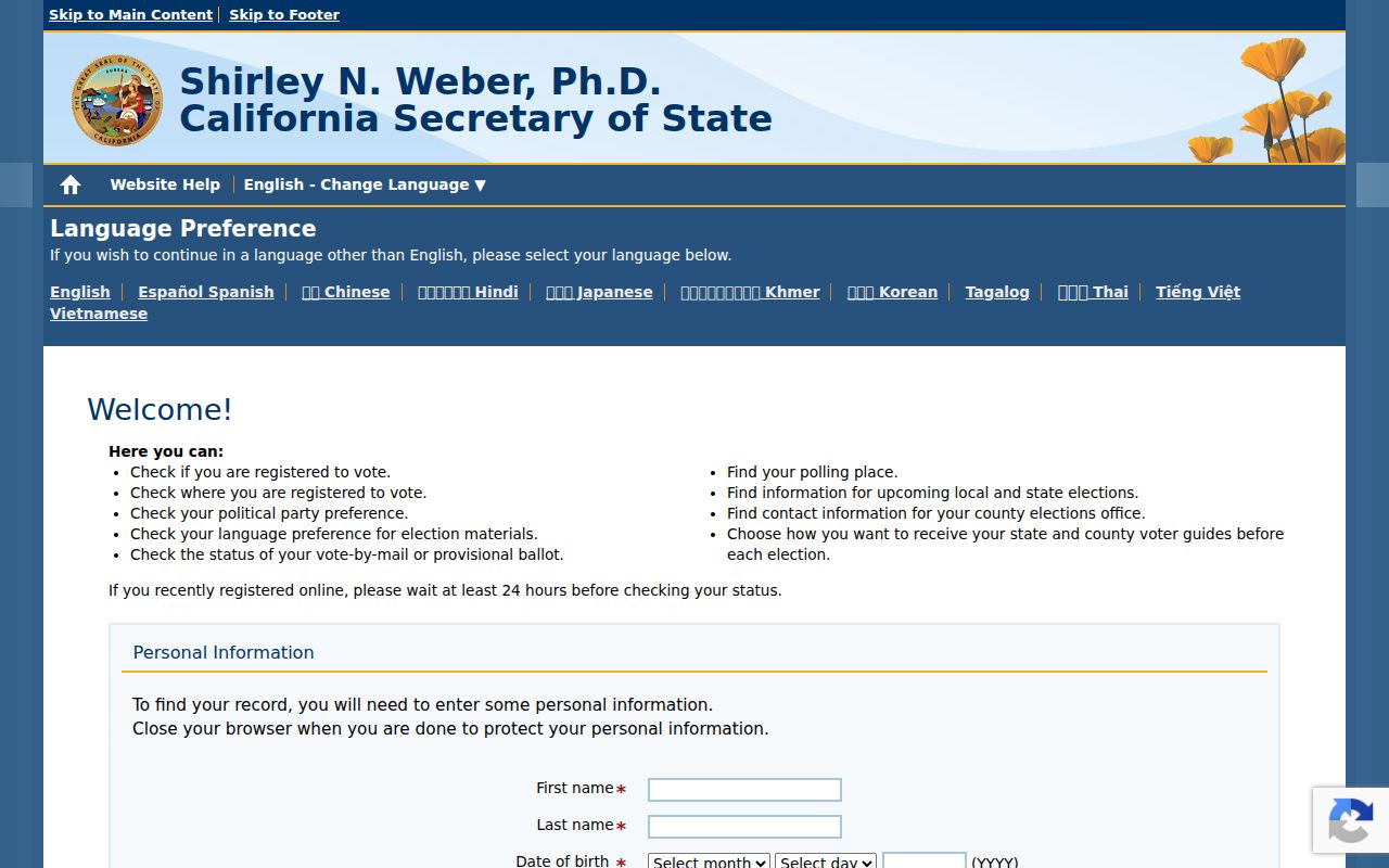
The form is a verification route, not a neighborhood directory. A no-match is not proof that a person has no local connection.
Tulare Neighbor Voter Data Gate
Elections Code section 2194 restricts voter-registration information to approved election, scholarly, journalistic, political, or governmental purposes and excludes commercial purposes. Government Code section 7924.000 protects home street address, phone, email, precinct and registration identifiers, prior registration information, driver-license or ID and SSN-related identifiers, and signatures outside the statutory voter-file regime.
An approved voter-file request identifies the requester and organization, intended statutory purpose, requested data or geography, and an agreement against unauthorized use. The researched Tulare file price, delivery media, and current county form were not verified. Historical poll books and registration registers should be requested from the County, State Archives, or Hillman by election year and precinct, but the exact local year run was not found.
The Secretary of State voter-information access rules explain the permitted-use framework.
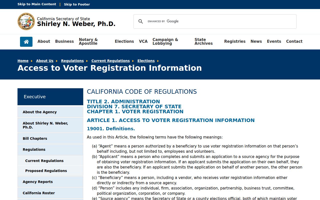
The state rules are why a legal voter-file route cannot become a republished Tulare block list.
Protected Tulare Neighbors May Be Missing
Safe at Home can provide a substitute mailing address, confidential voter registration, confidential name-change protection, and DMV suppression for eligible people. Children, roommates, non-owner occupants, utility customers, and protected voters may not appear in a parcel-based block search. A missing name is therefore weak negative evidence.
Government Code section 7924.000 is the state confidentiality boundary for sensitive voter fields. The official statute page gives the source text for the protected fields.
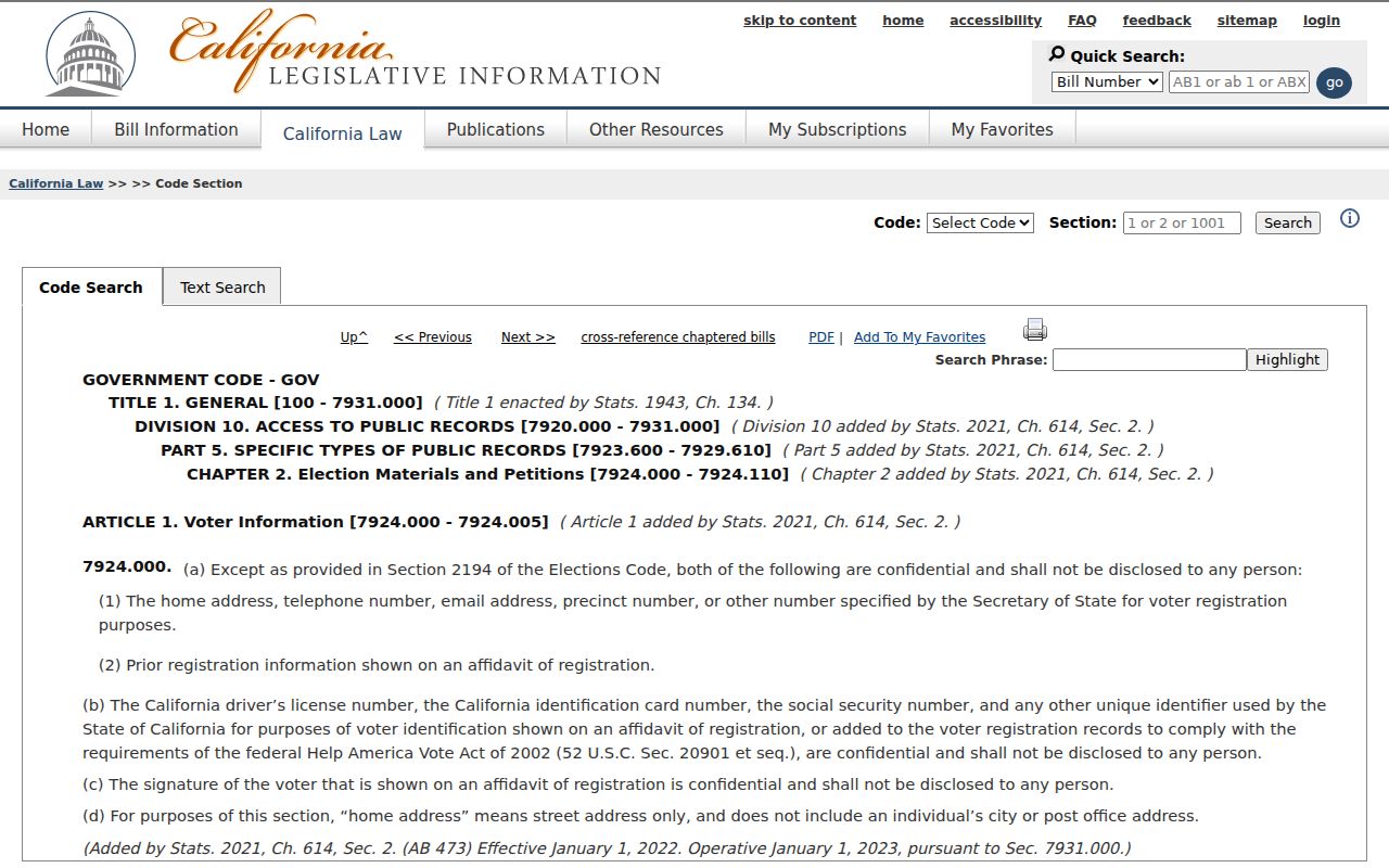
Privacy protections are part of the record's meaning, not a defect to work around.
Tulare Neighbor Community Contacts
Public community sources can help with neighborhood history without exposing a private member list. The research found Sequoia Genealogical Society as the leading local-memory partner through Hillman. It did not find an official City umbrella directory of neighborhood associations, HOA rosters, or public member lists. A Tulare neighbors directory should preserve that distinction between public history and private membership.
| Community resource | Public role | Access |
|---|---|---|
| Hillman Local History and Genealogy | Directories, newspapers, cemetery indexes, surname and subject files | 475 N. M. Street; Tuesday-Friday, 1-5 p.m.; 559-685-4518 |
| Sequoia Genealogical Society | Materials, volunteers, remote research questions | Route inquiries through Hillman or library contact channels |
| Neighborhood or HOA roster | No authoritative public directory verified | Do not infer or publish a private member list |
Organizations, congregations, alumni groups, fraternal groups, and veterans' rosters remain private unless deliberately published or deposited in an archive. That boundary keeps a community search useful without making private membership the target.
Tulare Neighbor Voter Participation
Where participation history is lawfully released, it can indicate whether a voter participated in an election. It never reveals a secret-ballot choice. A lawful voter record may include name, registration or status, and electoral geography, with sensitive fields withheld and Safe at Home voters specially protected.
The California Elections Code section 2194 page is the source for the permitted-use limit.
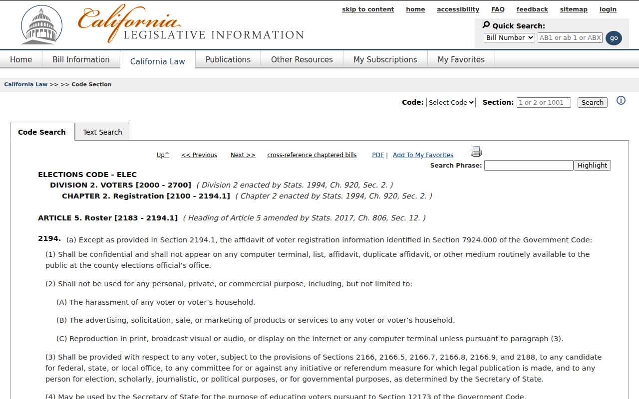
The statute keeps civic information within its lawful purpose and blocks a casual resident roster.
Tulare Neighbor Lookup Privacy
Official records are narrower but more traceable than commercial neighbor tools. A parcel viewer can identify land and an owner. A deed can identify an instrument party. A commercial database may merge stale or purchased data and is not a substitute for the custodian. Neither category should be used to force a current household conclusion.
| Source type | Strength | Limit |
|---|---|---|
| Official parcel, deed, or permit | Named custodian and record identifier | Usually land, instrument, or project facts |
| Historical directory or newspaper | Dated printed context | Gapped coverage and changing geography |
| Commercial neighbor tool | May combine many public and purchased inputs | Stale, merged, incomplete, and not official proof |
Lawful use. Use a Tulare neighbor lookup for block history, family reconnection, personal safety awareness, or civic curiosity. Do not use an address trail to stalk, harass, intimidate, or harm anyone.
If the question becomes a full named-street search, use the street directory. If it becomes a one-person identity question, use the resident lookup. The Tulare neighbors search is strongest when it stays at the block, parcel, and community layer.